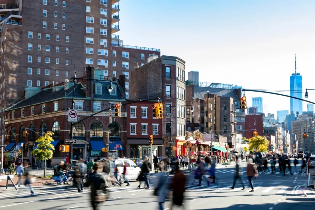
The iconic scene from the 1969 film "Midnight Cowboy," where Dustin Hoffman’s character, Ratso Rizzo, defiantly bangs on an encroaching taxi with the now-legendary cry, "I’m walkin’ here!", captures a timeless tension inherent in urban environments: the complex, often fraught, interplay between pedestrians and vehicular traffic. For decades, urban planners and policymakers have meticulously tracked the flow of cars, meticulously collecting data on vehicle miles traveled and traffic congestion. Yet, the human element – the rhythm of footsteps on sidewalks, the surge of people crossing streets – has largely remained an elusive metric, a blind spot in the comprehensive understanding of city life. This imbalance is now being addressed by a groundbreaking initiative from MIT, which has meticulously assembled the first comprehensive, routable dataset of sidewalks, crosswalks, and footpaths for all five boroughs of New York City. This monumental mapping project represents the inaugural complete model of pedestrian activity in any major U.S. city, promising to revolutionize urban planning and public space development.
The implications of this newly developed model are far-reaching. It provides urban planners with an unprecedented tool to make informed decisions regarding investments in pedestrian infrastructure and public spaces. By illuminating how development decisions can impact non-motorized travel, the study offers a critical lens through which to evaluate the long-term consequences of urban growth. Furthermore, the model excels at identifying specific locations throughout the city where high volumes of pedestrians intersect with significant safety hazards, such as traffic crashes. This granular insight allows for targeted interventions and upgrades to streets and intersections that are most in need of improvement, prioritizing pedestrian safety in a way that raw accident statistics alone could not achieve.
"We now have a first view of foot traffic all over New York City and can check planning decisions against it," stated Andres Sevtsuk, an associate professor in MIT’s Department of Urban Studies and Planning (DUSP) and the lead researcher on the study. "New York has very high densities of foot traffic outside of its most well-known areas." This observation directly challenges the prevailing assumption that pedestrian activity is concentrated solely in the bustling commercial and tourist hubs of Manhattan.
Unveiling the Boroughs: A New Perspective on Foot Traffic
One of the most significant revelations from the MIT model is the distribution of pedestrian traffic across New York City’s boroughs. While Manhattan indeed boasts the highest foot traffic per block, the study highlights that the outer boroughs contain substantial stretches of sidewalks with considerable pedestrian volumes. These areas, according to the research, could benefit significantly from increased investment in walker-friendly infrastructure.
"Midtown Manhattan has by far the most foot traffic, but we found that there is a probably unintentional Manhattan bias when it comes to policies that support pedestrian infrastructure," Sevtsuk explained. "There are a whole lot of streets in New York with very high pedestrian volumes outside of Manhattan, whether in Queens or the Bronx or Brooklyn, and we’re able to show, based on data, that a lot of these streets have foot-traffic levels similar to many parts of Manhattan." This finding is crucial for equitable urban development, suggesting that resources and attention dedicated to pedestrian improvements may need to be reallocated to ensure all New Yorkers, regardless of their borough, can navigate their communities safely and conveniently on foot.
Beyond Raw Numbers: Quantifying Pedestrian Risk
In an advancement with potential applications for cities nationwide, the MIT model moves beyond simply counting pedestrians and accidents. It enables the quantification of vehicle crashes involving pedestrians not just by their raw totals, but on a per-pedestrian basis. This shift in methodology provides a more nuanced understanding of risk, revealing where pedestrians are truly most vulnerable.
"A lot of cities put real investments behind keeping pedestrians safe from vehicles by prioritizing dangerous locations," Sevtsuk noted. "But that’s not only where the most crashes occur. Here we are able to calculate accidents per pedestrian, the risk people face, and that broadens the picture in terms of where the most dangerous intersections for pedestrians really are." This per-pedestrian risk assessment is a critical innovation, as it can help cities identify areas where even a moderate number of accidents represents a high level of danger for the individuals who frequent those locations.
The findings of this extensive research have been published in the latest issue of Nature Cities, under the title "Spatial Distribution of Foot-traffic in New York City and Applications for Urban Planning." The research team behind this ambitious project includes Sevtsuk, the Charles and Ann Spaulding Associate Professor of Urban Science and Planning at DUSP and head of the City Design and Development Group; Rounaq Basu, an assistant professor at Georgia Tech; Liu Liu, a PhD student at the City Form Lab in DUSP; Abdulaziz Alhassan, a PhD student at MIT’s Center for Complex Engineering Systems; and Justin Kollar, a PhD student at MIT’s Leventhal Center for Advanced Urbanism in DUSP.
The Genesis of the Model: Charting Global Footsteps
The current study builds upon a sustained effort by Sevtsuk and his colleagues to chart and model pedestrian traffic globally, with previous work undertaken in diverse locations ranging from Melbourne, Australia, to MIT’s own Kendall Square neighborhood in Cambridge, Massachusetts. While many cities collect some pedestrian count data, it is often fragmented and incomplete. Moreover, the established practice of requiring vehicle traffic impact assessments for new development plans rarely extends to a rigorous study of how these changes might affect pedestrian movement.
New York City, however, has demonstrated a commitment to pedestrian issues, with a dedicated portion of its Department of Transportation (DOT) focused on such concerns. Notably, approximately 41 percent of all trips within the city are made on foot, a figure that stands in stark contrast to the 28 percent made by vehicle. This ratio likely represents the highest proportion of walking trips of any major U.S. city, underscoring the importance of understanding and supporting pedestrian mobility.
To calibrate their sophisticated model, the MIT team utilized pedestrian count data recorded by the New York City DOT in 2018 and 2019. This data encompassed up to 1,000 city sidewalk segments on weekdays and approximately 450 segments on weekends, providing a robust foundation for the research. The researchers then employed a model that incorporates a wide array of influencing factors, rigorously testing its accuracy against the collected New York City pedestrian count data. Once calibrated, the model’s predictive capabilities allowed it to expand foot-traffic estimates to cover the entire city, extending beyond the specific points where direct observations had been made.
Quantifying the Urban Flow: Peaks, Valleys, and Varied Journeys
The results of the MIT model paint a detailed picture of New York City’s pedestrian landscape. During the evening peak of foot traffic, Midtown Manhattan emerged as the busiest area, with an average of 1,697 pedestrians per sidewalk segment per hour. The financial district in lower Manhattan followed, registering 740 pedestrians per hour, with Greenwich Village ranking third at 656 pedestrians per hour.
However, the data also revealed that other parts of Manhattan experience significantly lower foot traffic levels. Morningside Heights and East Harlem, for instance, recorded 226 and 227 pedestrians per block per hour, respectively. These figures are comparable to, or even lower than, those in some sections of the outer boroughs. Brooklyn Heights saw 277 pedestrians per sidewalk segment per hour, while University Heights in the Bronx recorded 263. Borough Park in Brooklyn and the Grand Concourse in the Bronx averaged 236 pedestrians per hour, and a segment of Queens in the Corona area averaged 222. Numerous other locations across the city also registered pedestrian volumes exceeding 200 pedestrians per hour.
The model’s ability to overlay different types of pedestrian journeys for each time period further enhances its utility. It demonstrates that morning commutes are primarily driven by trips to work and schools. As the day progresses into midday and evening, travel patterns become more varied, with people seeking out amenities, engaging in social activities, or undertaking recreational pursuits.
"Because of jobs, transit stops are the biggest generators of foot traffic in the morning peak," observed Liu Liu, a PhD student at MIT’s City Form Lab. "In the evening peak, of course, people need to get home too, but patterns are much more varied, and people are not just returning from work or school. More social and recreational travel happens after work, whether it’s getting together with friends or running errands for family or family care trips, and that’s what the model detects too." This understanding of trip purpose is invaluable for designing public spaces that cater to diverse needs throughout the day.
Navigating the Perils: A New Metric for Pedestrian Safety
The study’s findings on pedestrian safety are particularly impactful. They underscore that danger is not confined to intersections with the highest total number of accidents. Many areas of the city pose a greater risk to pedestrians on a per-pedestrian basis than locations experiencing a higher absolute number of crashes.
"Places like Times Square and Herald Square in Manhattan may have numerous crashes, but they have very high pedestrian volumes, and it’s actually relatively safe to walk there," explained Rounaq Basu, a co-author of the study. "There are other parts of the city, around highway off-ramps and heavy car-infrastructure, including the relatively low-density borough of Staten Island, which turn out to have a disproportionate number of crashes per pedestrian." This insight challenges the conventional approach to safety planning, which often prioritizes locations with the highest crash counts, potentially overlooking areas where a smaller number of crashes may indicate a higher inherent risk for the individuals present.
A Blueprint for Urban Futures: National and International Applications
The MIT pedestrian traffic model is poised for significant adoption within New York City’s policy and planning circles. City officials are reportedly aware of the research and have engaged in ongoing discussions with the MIT team. This direct engagement suggests a strong likelihood of the model’s integration into future urban development strategies and infrastructure planning.
Andres Sevtsuk emphasized the model’s scalability, noting that while New York City is a unique urban environment, the framework developed by MIT can be readily applied to cities and towns across the United States and beyond. The research team is currently collaborating with municipal officials in two other key locations. In Los Angeles, city leaders are not only focused on enhancing pedestrian and public transit mobility for daily commutes but are also strategizing to accommodate the influx of visitors expected for the 2028 Summer Olympics. Simultaneously, the state of Maine is working with the MIT team to assess pedestrian movement across more than 140 of its cities and towns, aiming to identify optimal areas for upgrades and safety improvements statewide.
Sevtsuk expressed hope that the New York City study will inspire other municipalities to invest in similar foot-traffic modeling and pedestrian infrastructure mapping initiatives. "Very few cities make plans for pedestrian mobility or examine rigorously how future developments will impact foot-traffic. But they can. Our models serve as a test bed for making future changes," he asserted. This call to action highlights the critical need to shift urban planning paradigms away from the 20th-century’s disproportionate focus on car travel and towards a more balanced approach that prioritizes sustainable and human-centered mobility. By providing a comprehensive understanding of how people move through their cities, the MIT model offers a powerful tool for decarbonization efforts and the creation of more equitable, livable urban environments for all.