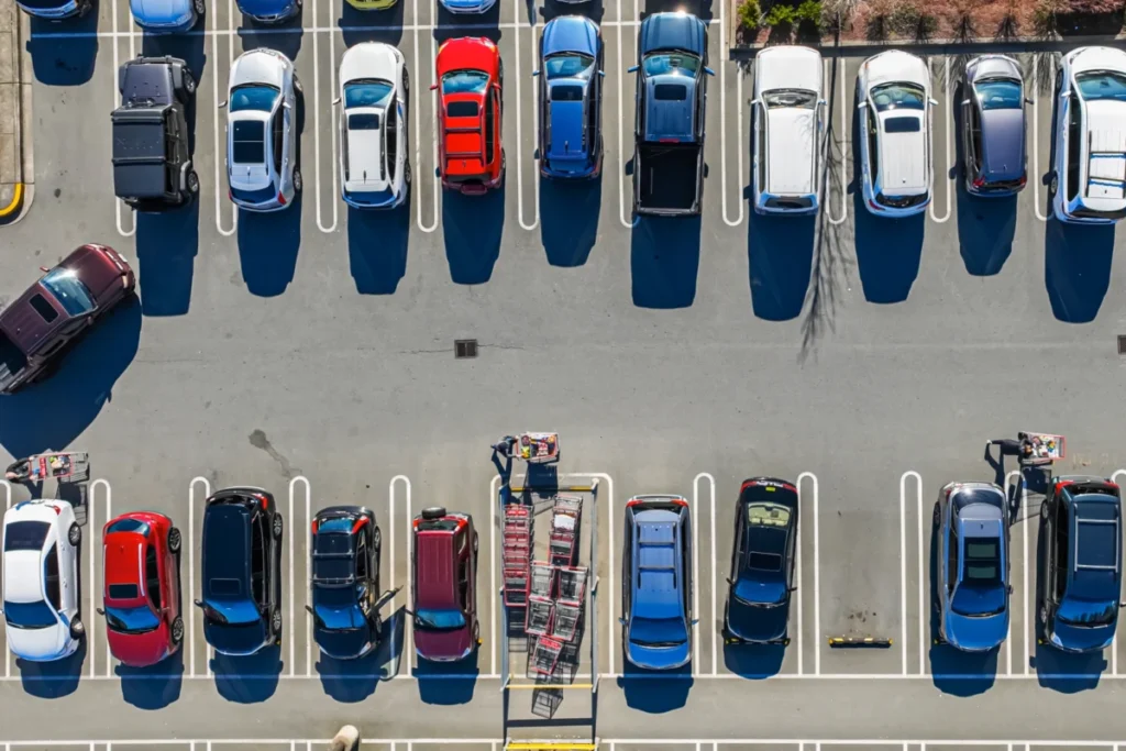
The daily grind of urban commuting often includes a frustrating final act: circling for a parking spot, turning a quick trip into a time-consuming ordeal. While popular navigation apps efficiently guide drivers to their destinations, they conspicuously omit a crucial variable: the often-elusive reality of parking availability. This oversight, MIT researchers argue, not only leads to personal inconvenience but also exacerbates urban congestion and environmental concerns. To address this pervasive issue, a team at the Massachusetts Institute of Technology has developed an innovative system designed to integrate parking probability into navigation, potentially revolutionizing how we approach urban travel.
The current paradigm of navigation systems typically directs users to the precise coordinates of their destination without factoring in the time and effort required to secure a parking space. This can result in drivers arriving at their intended location only to find themselves engaged in a protracted search for parking, leading to significant delays and increased stress. The consequences extend beyond individual frustration; this "parking penalty" contributes to increased vehicle miles traveled as drivers cruise in search of a spot, thereby raising fuel consumption and emissions. Furthermore, the unpredictability of parking can deter individuals from considering public transportation, as they may underestimate its potential efficiency compared to the perceived ease of driving, despite the hidden parking challenges.
This critical gap in navigation technology has spurred researchers at MIT to engineer a sophisticated system that actively identifies parking lots offering an optimal balance between proximity to the desired destination and a high likelihood of available spaces. Rather than solely directing drivers to their ultimate endpoint, the adaptable methodology guides them to the most advantageous parking area, accounting for the entire journey from arrival to destination.
Simulated tests, utilizing real-world traffic data from Seattle, have demonstrated the system’s remarkable efficacy. In the most congested urban scenarios, the MIT approach achieved time savings of up to an impressive 66 percent. This translates to a tangible reduction in travel time for motorists, potentially saving an average of 35 minutes per trip compared to the conventional method of waiting for a spot to open in the closest available parking lot. While a fully deployed, real-world application is still under development, these initial demonstrations underscore the profound viability and potential impact of this parking-aware navigation strategy.
Cameron Hickert, an MIT graduate student and lead author of the research paper detailing this work, emphasized the systemic implications of current navigation limitations. "This frustration is real and felt by a lot of people," Hickert stated, "and the bigger issue here is that systematically underestimating these drive times prevents people from making informed choices. It makes it that much harder for people to make shifts to public transit, bikes, or alternative forms of transportation."
The research team, comprised of Hickert, Sirui Li (PhD ’25), Zhengbing He (a research scientist in the Laboratory for Information and Decision Systems – LIDS), and senior author Cathy Wu (Associate Professor in Civil and Environmental Engineering and the Institute for Data, Systems, and Society at MIT, and a member of LIDS), published their findings in the Transactions on Intelligent Transportation Systems.
The Probabilistic Approach to Parking
The core of the MIT researchers’ solution lies in a probability-aware framework that meticulously analyzes all potential public parking lots in proximity to a given destination. This system considers several key factors: the driving distance from the user’s origin to each parking lot, the walking distance from each lot to the final destination, and, crucially, the estimated probability of securing a parking space.
Leveraging principles of dynamic programming, the method works backward from favorable outcomes to calculate the most efficient route for the user. This iterative process ensures that the system not only identifies the parking lot with the highest probability of availability but also accounts for scenarios where a user might arrive at their initially targeted lot only to find it full. In such instances, the system calculates the subsequent best course of action, factoring in the distances to alternative parking lots and their respective probabilities of success.
"If there are several lots nearby that have slightly lower probabilities of success, but are very close to each other, it might be a smarter play to drive there rather than going to the higher-probability lot and hoping to find an opening," explained Hickert. "Our framework can account for that." Ultimately, the system is designed to pinpoint the optimal parking lot that minimizes the total expected time required for driving, parking, and walking to the destination.
A critical element of this system’s sophistication is its incorporation of the behavior of other drivers. Recognizing that urban parking is a competitive environment, the framework models how the actions of other motorists can influence an individual’s probability of finding a parking spot. This includes scenarios where another driver might secure the last spot in a preferred lot, or where unsuccessful attempts at other lots might lead drivers to reconsider and attempt parking in the user’s initially targeted area. Furthermore, the system accounts for "spillover effects," where parking in one lot might indirectly impact availability in nearby areas.
"With our framework, we show how you can model all those scenarios in a very clean and principled manner," Hickert elaborated, highlighting the system’s ability to handle the complex, interconnected dynamics of urban parking.
Leveraging Crowdsourced Data for Real-Time Insights
The accuracy of any parking prediction system hinges on the quality and timeliness of its data. While some advanced parking facilities are equipped with sensors or gates that track vehicle ingress and egress, such infrastructure is not universally deployed. To ensure broader applicability and feasibility for real-world implementation, the MIT researchers explored the effectiveness of utilizing crowdsourced data.
This approach envisions users of navigation apps contributing information about parking availability. Such data could be gathered by tracking the number of vehicles actively searching for parking, or by noting how many cars enter a lot and subsequently exit without successfully parking. In a forward-looking perspective, future autonomous vehicles could even be programmed to report on available parking spots as they navigate through urban areas.
"Right now, a lot of that information goes nowhere," noted Hickert. "But if we could capture it, even by having someone simply tap ‘no parking’ in an app, that could be an important source of information that allows people to make more informed decisions."
The research team rigorously evaluated their system using real-world traffic data from the Seattle metropolitan area. They simulated various times of day in both a densely congested urban setting and a less busy suburban environment. The results were compelling: in congested settings, their parking-aware approach reduced total travel time by approximately 60 percent when compared to simply waiting for a spot, and by about 20 percent compared to a strategy of continuously driving to the nearest available parking lot.
Furthermore, their analysis indicated that crowdsourced observations of parking availability, even with a potential error rate of around 7 percent compared to actual availability, could serve as an effective mechanism for gathering crucial parking probability data. This suggests that a relatively simple user input system could significantly enhance the accuracy and utility of navigation.
Broader Implications and Future Directions
The implications of this research extend far beyond reducing individual commute times. By providing more accurate travel time estimates that incorporate parking realities, the system has the potential to fundamentally alter urban mobility patterns. If drivers can reliably anticipate parking availability and associated time costs, they may be more inclined to opt for public transportation, cycling, or walking for shorter trips, thereby alleviating pressure on road networks and contributing to a more sustainable urban environment.
The potential for significant reductions in traffic congestion is a key benefit. The hours drivers spend circling for parking contribute substantially to gridlock, particularly in downtown areas. By guiding drivers to more opportune parking locations, even if slightly further afield, the system can reduce the overall number of vehicles circulating aimlessly, leading to smoother traffic flow and shorter travel times for all road users.
Moreover, the environmental benefits are substantial. Reduced cruising time translates directly to lower fuel consumption and decreased emissions of greenhouse gases and other air pollutants. In an era where cities worldwide are grappling with air quality issues and climate change targets, solutions that can demonstrably reduce vehicle emissions are of paramount importance.
Looking ahead, the MIT researchers aim to scale up their studies. Their future plans include conducting larger-scale analyses using real-time route information across entire cities. They are also keen to explore novel avenues for data acquisition, such as utilizing satellite imagery, and to quantify the potential emissions reductions attributable to their system.
Professor Cathy Wu underscored the transformative potential of small, data-driven changes within complex transportation systems. "Transportation systems are so large and complex that they are really hard to change," she commented. "What we look for, and what we found with this approach, is small changes that can have a big impact to help people make better choices, reduce congestion, and reduce emissions."
The research was made possible through the generous support of Cintra, the MIT Energy Initiative, and the National Science Foundation, highlighting a collaborative effort to tackle one of the most persistent challenges of modern urban living. As cities continue to grow and evolve, innovative solutions like MIT’s parking-aware navigation system offer a promising pathway towards more efficient, sustainable, and less frustrating urban transportation. The daily frustration of the empty parking spot may soon become a relic of the past, thanks to a more intelligent and holistic approach to navigation.