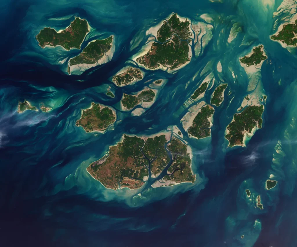
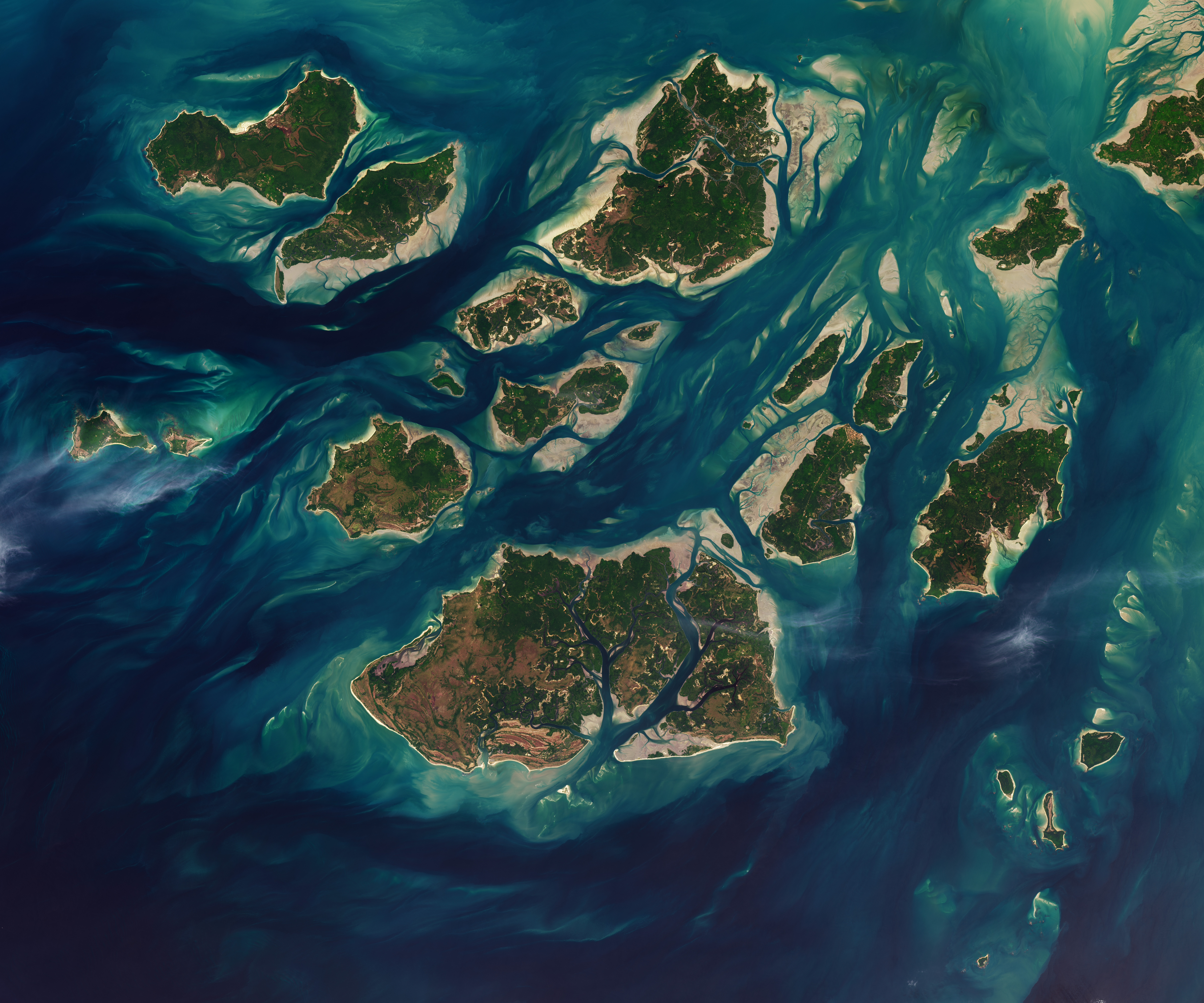
Twice each day, a colossal spectacle of nature unfolds across the Bijagós Archipelago, a remote chain of 88 islands and islets off the coast of Guinea-Bissau. This UNESCO World Biosphere Reserve, a labyrinth of sandy channels, expansive mudflats, and dense mangrove forests, is profoundly sculpted by the relentless ebb and flow of the Atlantic tides. As captured in a striking image taken on November 28, 2025, by NASA and the USGS, the amphibious nature of this landscape transforms dramatically. At low tide, vast expanses of intertidal mudflats and sandflats emerge from the sea, seemingly expanding the islands’ territories, only to be submerged again hours later as the tide reclaims its dominion. This ceaseless cycle not only defines the physical geography of the Bijagós but also underpins its extraordinary biodiversity, making it a crucial natural laboratory for understanding the intricate relationships between land, sea, and life.
The Tidal Engine of Transformation
The dramatic alteration of the Bijagós landscape is a direct consequence of its unique geographical positioning and the powerful tidal forces of the Atlantic Ocean. The archipelago lies in a region characterized by significant tidal ranges, meaning the difference between high tide and low tide can be substantial. This diurnal rhythm, occurring roughly twice every 24 hours, dictates the daily life of the islands and their inhabitants, both human and animal.
At high tide, the waters surge inland, inundating the lower-lying areas and creating a network of navigable channels through the mangroves. Many of these channels become impassable or significantly altered as the tide recedes. The exposed mudflats and sandflats, rich in organic matter and teeming with invertebrates, become accessible foraging grounds for a multitude of bird species and marine life. This daily cycle of inundation and exposure is a fundamental ecological driver, influencing nutrient cycling, sediment deposition, and the very habitats available to the archipelago’s diverse flora and fauna.
The visual evidence from the NASA/USGS image vividly illustrates this phenomenon. The contrast between the water-covered areas at high tide and the exposed intertidal zones at low tide is stark. This dynamic interplay of land and sea is not a static feature but a constantly evolving process. Over geological timescales, these tidal movements contribute to the erosion and accretion of coastlines, shaping the islands’ contours and influencing the formation of new sandbanks and channels.
A Haven for Biodiversity: The Bijagós’ Ecological Significance
The Bijagós Archipelago is far more than just a visually dynamic landscape; it is a global hotspot for biodiversity. Its isolation, coupled with the unique tidal regime, has fostered the evolution of distinct ecosystems and provided critical habitats for numerous species, many of which are globally threatened.
Marine Life: The nutrient-rich waters surrounding the Bijagós are a vital breeding and feeding ground for a wide array of marine life. The mangrove roots, exposed at low tide, provide nurseries for fish and crustaceans. The intertidal zones are crucial feeding grounds for wading birds, while the surrounding waters support significant populations of dolphins, sea turtles, and various fish species. The archipelago is particularly renowned for its significant populations of green sea turtles and olive ridley sea turtles, which use the islands’ beaches for nesting. The Atlantic humpback dolphin also finds refuge in these waters.
Avian Sanctuary: The exposed mudflats and shallow waters at low tide are a magnet for migratory and resident bird species. Waders, shorebirds, and waterfowl find abundant food sources in the exposed invertebrates. The islands also support a variety of resident bird species adapted to the coastal environment. The archipelago is recognized as an Important Bird Area (IBA) by BirdLife International, highlighting its critical role in supporting global bird populations.
Mangrove Ecosystems: The extensive mangrove forests that fringe the islands are the lifeblood of the Bijagós ecosystem. These unique trees, adapted to saline and waterlogged conditions, stabilize coastlines, protect against erosion, and act as natural filters for water. Their intricate root systems provide shelter and breeding grounds for countless marine organisms, forming the base of a complex food web. The mangroves also play a crucial role in carbon sequestration, contributing to global climate regulation.
Historical Context and Human Interaction
The Bijagós Archipelago has a long history of human habitation, with indigenous communities who have adapted their lives to the rhythm of the tides for centuries. The Bijagós people have developed a deep understanding of their environment, relying on fishing, small-scale agriculture, and the harvesting of forest products. Their traditional practices have often been sustainable, reflecting a harmonious relationship with the natural world.
However, the archipelago has also faced external pressures. During the colonial era, the islands were exploited for resources, and in recent decades, issues such as illegal fishing, habitat degradation due to unsustainable development, and the impacts of climate change have posed significant challenges to the delicate ecosystem.
The establishment of the Bijagós Archipelago National Park and its designation as a UNESCO World Biosphere Reserve in 1996 were critical steps towards protecting this invaluable natural heritage. These designations aim to promote conservation while also supporting sustainable development and the well-being of the local communities.
Supporting Data and Scientific Observations
Scientific research conducted in the Bijagós Archipelago has provided invaluable data on its ecological significance and the processes shaping its environment.
- Tidal Range: The average tidal range in the Bijagós Archipelago can exceed 4 meters (approximately 13 feet), with spring tides reaching even higher. This substantial range is a primary driver of the intertidal zone’s extent and dynamism.
- Biodiversity Surveys: Studies have documented hundreds of bird species, a significant number of which are migratory, relying on the Bijagós as a critical stopover point. The archipelago is also a vital nesting site for several species of sea turtles, with thousands of nests recorded annually.
- Mangrove Coverage: The mangrove forests cover a substantial portion of the land area within the archipelago, providing essential habitat and ecosystem services. Research indicates that these forests are remarkably resilient but also vulnerable to changes in sea level and human impact.
- Fisheries: The waters around the Bijagós are highly productive, supporting a rich diversity of fish species. These fisheries are crucial for the local economy and for sustaining marine food webs. However, concerns about overfishing and the impact of industrial fishing fleets operating in the region have been raised by conservation organizations.
Timeline of Key Events and Conservation Efforts
While the natural processes of the Bijagós have been unfolding for millennia, specific milestones mark efforts to understand and protect this unique environment:
- Pre-colonial Era: Indigenous Bijagós communities establish settlements and develop sustainable resource management practices.
- Colonial Period (late 19th – mid-20th century): Limited colonial presence, with some resource exploitation.
- Post-independence (1974 onwards): Guinea-Bissau gains independence; growing awareness of the archipelago’s ecological value.
- 1996: The Bijagós Archipelago is designated as a UNESCO World Biosphere Reserve, acknowledging its outstanding universal value for conservation and sustainable development.
- 1997: The Bijagós Archipelago National Park is established, providing a legal framework for its protection.
- Ongoing: Numerous international and local conservation organizations initiate projects focused on marine conservation, sustainable fisheries management, community empowerment, and eco-tourism.
- November 28, 2025: NASA/USGS capture the image highlighting the dramatic tidal changes.
- August 03, 2026: Publication of the news article based on the image and broader context.
Perspectives and Challenges
The dynamic nature of the Bijagós Archipelago presents both opportunities and challenges for conservation and local communities.
Conservationists emphasize the global importance of the Bijagós as a refuge for endangered species and a model for sustainable coastal ecosystem management. They highlight the need for continued vigilance against threats such as illegal fishing, habitat destruction, and the pervasive impacts of climate change, including rising sea levels and changing weather patterns, which could alter the delicate balance of the intertidal zones and mangrove ecosystems.
Local Communities, while often deeply connected to their environment, also face economic pressures. Sustainable livelihoods that balance resource utilization with conservation are crucial. Initiatives that support eco-tourism, sustainable fishing practices, and the development of local enterprises can provide economic alternatives while fostering a sense of stewardship.
Scientific Researchers continue to explore the intricate ecological processes at play in the Bijagós. Understanding the long-term impacts of climate change on tidal patterns, mangrove health, and species migration is vital for developing effective conservation strategies. The archipelago serves as a critical site for studying the resilience of coastal ecosystems in the face of global environmental change.
Broader Impact and Implications
The Bijagós Archipelago’s unique tidal-driven landscape offers critical insights into several broader implications:
- Climate Change Resilience: The archipelago’s ability to adapt to fluctuating sea levels and tidal patterns can provide valuable lessons for other coastal regions facing similar challenges. Studying the resilience of its mangrove forests and the adaptation strategies of its wildlife can inform global efforts to mitigate and adapt to climate change.
- Sustainable Coastal Management: The success of conservation efforts in the Bijagós, which often involve close collaboration with local communities, can serve as a blueprint for sustainable coastal management worldwide. The recognition of traditional ecological knowledge alongside scientific research is often key to effective conservation.
- Global Biodiversity Hotspots: The Bijagós exemplifies the critical importance of protecting unique biodiversity hotspots. These areas are not only reservoirs of species diversity but also provide essential ecosystem services that benefit humanity on a global scale, from carbon sequestration to the provision of fisheries resources.
- The Power of Natural Rhythms: The daily spectacle of the tides in the Bijagós serves as a powerful reminder of the profound influence of natural rhythms on ecosystems. Understanding and respecting these rhythms is fundamental to preserving the health and vitality of our planet’s natural heritage.
In conclusion, the Bijagós Archipelago, with its islands that seem to expand and contract with the rhythm of the tides, stands as a testament to the dynamic and interconnected nature of our planet’s ecosystems. The stark visual transformation captured in the NASA/USGS image is a powerful metaphor for the constant, yet often unseen, processes that shape our world, and underscores the urgent need for continued scientific study and robust conservation efforts to safeguard these invaluable natural treasures for future generations.