A groundbreaking study by researchers at the Massachusetts Institute of Technology (MIT) Senseable City Lab has unveiled a revolutionary method for generating near real-time, high-resolution maps of auto emissions in urban environments. Leveraging existing sensor networks and anonymized mobile data, this innovative approach promises to equip city planners and policymakers with unprecedented granular insights, paving the way for more effective transportation and decarbonization strategies.
The new methodology stands in stark contrast to conventional emission assessment techniques, which often rely on infrequent and less detailed sampling of vehicle exhaust. The MIT team’s work bridges a significant gap between broad, citywide emissions inventories and highly specific analyses of individual vehicle performance. By integrating multiple data streams, including real-time traffic camera feeds and extensive anonymized location data from mobile devices, the researchers have demonstrated the feasibility of creating emission maps with a resolution as fine as a single road segment and an hourly interval. This level of detail, previously considered unattainable without extensive and costly infrastructure, offers a powerful new lens through which to understand and mitigate urban pollution.
"Our model, by combining real-time traffic cameras with multiple data sources, allows extrapolating very detailed emission maps, down to a single road and hour of the day," stated Paolo Santi, a principal research scientist at the MIT Senseable City Lab and co-author of the study published in Nature Sustainability. "Such detailed information can prove very helpful to support decision-making and understand effects of traffic and mobility interventions."
Carlo Ratti, director of the MIT Senseable City Lab, emphasized the project’s alignment with the lab’s broader mission. "This research is part of our lab’s ongoing quest into hyperlocal measurements of air quality and other environmental factors," Ratti explained. "By integrating multiple streams of data, we can reach a level of precision that was unthinkable just a few years ago – giving policymakers powerful new tools to understand and protect human health."
A key advantage of this new framework is its inherent privacy-preserving nature. The computer vision techniques employed by the researchers are designed to identify vehicle types without collecting or processing license plate information. This ensures that while the data provides rich insights into traffic flow and pollution, individual drivers’ privacy remains protected. The study effectively harnesses existing urban infrastructure, from traffic cameras to the ubiquitous presence of mobile devices, to extract more valuable data on vehicle movement and its environmental consequences.
"The very basic idea is just to estimate traffic emissions using existing data sources in a cost-effective way," explained Songhua Hu, a former postdoc at the Senseable City Lab and now an assistant professor at the City University of Hong Kong, who led the development of the core methodology.
Manhattan as a Living Laboratory: Data Fusion for Granular Insights
To validate their framework, the MIT researchers focused their study on Manhattan, New York City, a densely populated and complex urban environment. The study leveraged data from 331 traffic cameras strategically positioned at intersections across the borough. These cameras, already in place for traffic management, provided crucial visual information about vehicle presence and movement.
Complementing the camera data, the researchers incorporated anonymized location records from over 1.75 million mobile phones. This vast dataset offered a comprehensive view of traffic patterns and the movement of individual vehicles throughout the city, providing insights into origin-destination flows and overall mobility trends.
The core of the MIT methodology involves sophisticated vehicle-recognition algorithms. These programs were trained to categorize vehicles into 12 broad classes. The study reported an impressive accuracy rate, correctly classifying 93 percent of vehicles into their respective categories. This high level of accuracy is critical for estimating emissions, as different vehicle types (e.g., passenger cars, heavy-duty trucks, buses) have distinct emission profiles.
Furthermore, the analysis of camera footage provided invaluable data on the impact of traffic signal timing on traffic flow. This is a crucial factor, as stop-and-go driving patterns induced by traffic signals are significant contributors to urban emissions, yet are often overlooked or simplified in traditional emission inventories. By quantifying the impact of signalization, the model accounts for a major driver of localized pollution hotspots.
The fusion of this visual data with the mobile phone location records allowed the scholars to construct detailed maps of vehicle movement. By combining these insights with established emission rate data for various vehicle types, the researchers were able to generate precise estimates of traffic emissions across Manhattan.
"We just need to input all emission-related information based on existing urban data sources, and we can estimate the traffic emissions," Hu stated, highlighting the model’s efficiency and reliance on readily available information.
Scenario Modeling: Predicting the Impact of Policy Interventions
Beyond simply mapping current emissions, the MIT framework possesses a powerful predictive capability. The researchers demonstrated its utility in evaluating the potential impact of various policy interventions and shifts in transportation behavior. By altering input parameters within the model, they could simulate different future scenarios and forecast their effects on emissions.
One key scenario explored the impact of shifting travel demand from private vehicles to public transportation, such as buses. By modeling a hypothetical increase in bus ridership and a corresponding decrease in private car usage, the researchers could quantify the projected reduction in emissions.
Another scenario investigated the potential benefits of smoothing out peak hour traffic. By simulating a slight extension of morning and evening rush hours, leading to a less concentrated volume of vehicles on the road at any given time, the model aimed to predict the associated emission changes. This type of analysis is crucial for understanding how traffic management strategies can contribute to cleaner air.
The study also highlighted the critical importance of data granularity by modeling the consequences of using citywide average emission factors versus the highly detailed, road-segment-specific estimates generated by their framework. The findings were stark: using simplified, citywide averages could lead to emission estimates that varied wildly, ranging from a 49 percent underestimation to a 25 percent overestimation compared to the more refined results. This underscores how even seemingly minor simplifications in data can introduce substantial inaccuracies into emission assessments, potentially leading to misguided policy decisions.
Congestion Pricing: Real-World Validation of a Powerful Tool
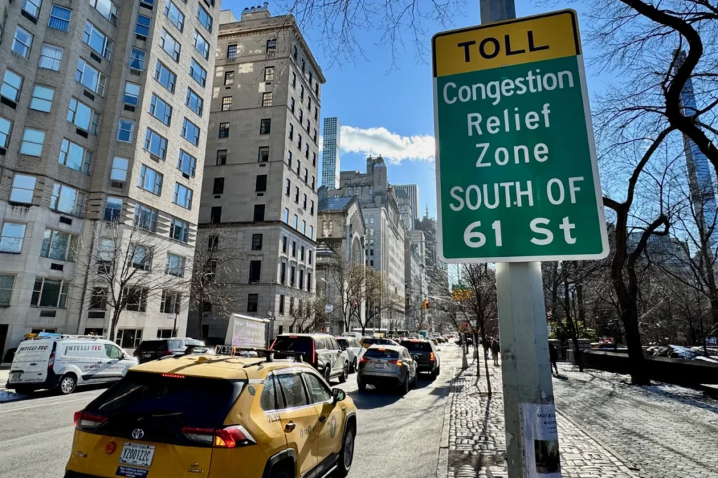
The research team seized an opportunity to test their model’s efficacy in a real-world policy implementation: New York City’s congestion pricing program, which officially launched in January 2025, introducing tolls for vehicles entering the most congested areas of Manhattan south of 60th Street.
The MIT researchers analyzed vehicle traffic data at two, four, six, and eight weeks following the program’s inception. Their findings indicated that congestion pricing led to an approximate 10 percent reduction in overall traffic volume within the pricing zone. Crucially, this reduction in traffic was accompanied by a significant drop in emissions, estimated to be between 16 and 22 percent.
This outcome closely aligns with independent research. A prior study by Cornell University researchers, for instance, reported a 22 percent decrease in fine particulate matter (PM2.5) levels within the congestion pricing zone. The MIT team’s analysis further revealed that the emission reductions were not uniformly distributed across the network. Some major arteries experienced more substantial declines, while areas outside the immediate pricing zone showed more varied effects, suggesting a ripple impact of the policy.
"We see these kinds of huge changes after the congestion pricing began," Hu commented. "I think that’s a demonstration that our model can be very helpful if a government really wants to know if a new policy converts into real-world impact." The ability to provide near real-time, quantifiable evidence of policy effectiveness is a significant advancement for urban governance.
Expanding the Horizon: Future Data Integration and Global Applicability
The researchers are keen to emphasize the adaptability of their framework. The core methodology can be enriched by incorporating additional data sources. In related work conducted in Amsterdam, for example, the team successfully integrated data from dashboard cameras installed in vehicles. This provided an even richer dataset on vehicle movement and operational characteristics.
Fábio Duarte, associate director of research and design at the MIT Senseable City Lab, who has been instrumental in developing related studies, expressed optimism about the model’s scalability. "With our model, we can make any camera used in cities, from the hundreds of traffic cameras to the thousands of dash cams, a powerful device to estimate traffic emissions in real-time," Duarte stated. This suggests a future where a vast network of existing cameras, both public and private, can contribute to a dynamic and detailed understanding of urban air quality.
The implications of this research are far-reaching. For urban planners, the ability to pinpoint emission sources with such precision can inform targeted interventions. This could include optimizing traffic signal timing in pollution hotspots, designing more effective low-emission zones, or planning infrastructure that encourages modal shifts. For public health officials, a clearer understanding of where and when pollution is most severe can help identify vulnerable populations and develop more effective public health advisories.
The study was supported by grants from the city of Amsterdam, the AMS Institute, and Abu Dhabi’s Department of Municipalities and Transport. Additional support was provided by the MIT Senseable City Consortium, a collaborative network including Atlas University, the city of Laval, the city of Rio de Janeiro, Consiglio per la Ricerca in Agricoltura e l’Analisi dell’Economia Agraria, the Dubai Future Foundation, FAE Technology, KAIST Center for Advanced Urban Systems, Sondotecnica, Toyota, and Volkswagen Group America. This broad base of support underscores the international interest and recognition of the project’s potential to address critical urban challenges.
As cities worldwide grapple with the dual imperatives of improving quality of life and mitigating climate change, the MIT Senseable City Lab’s innovative framework offers a vital new tool. By transforming readily available data into actionable intelligence, it empowers cities to move beyond broad assumptions and toward data-driven, precise, and effective environmental policies. The era of hyper-local emissions monitoring has arrived, promising cleaner air and healthier urban environments for all.