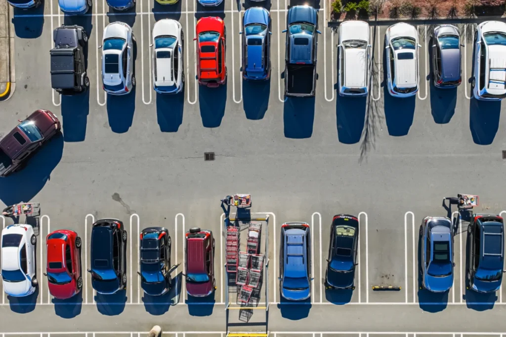
The daily frustration of navigating urban environments, only to find a destination devoid of parking, is a ubiquitous problem plaguing commuters. This common experience, where the projected arrival time on a navigation app proves wildly optimistic, leads to significant delays, heightened stress, and contributes to a cascade of negative consequences for city dwellers and the environment. Researchers at the Massachusetts Institute of Technology (MIT) have now developed an innovative system that tackles this pervasive issue head-on, aiming to provide drivers with a more realistic and efficient travel experience by integrating parking availability into navigation algorithms.
The current paradigm of most popular navigation systems operates on a fundamental flaw: they direct users to a specific geographic point without accounting for the often-considerable time and effort required to secure parking. This oversight extends beyond mere inconvenience, manifesting as tangible problems such as increased traffic congestion as drivers circle blocks in search of a spot, elevated vehicle emissions from prolonged idling and slow-speed cruising, and a disincentive for individuals to consider public transportation options, which might, in reality, be a faster and more predictable mode of travel.
The groundbreaking work by MIT researchers, detailed in a recent publication, introduces an adaptable method designed to identify parking lots that strike an optimal balance between proximity to the desired destination and a high probability of available spaces. Instead of simply guiding drivers to the doorstep of their destination, this novel system directs them to the most advantageous parking area, factoring in the entire journey from arrival at the parking zone to reaching their ultimate goal.
Simulated tests, employing real-world traffic data meticulously collected from Seattle, have demonstrated the efficacy of this advanced technique. In scenarios characterized by peak congestion, the system achieved impressive time savings of up to an astounding 66 percent. For an individual motorist, this translates to a potential reduction in travel time of approximately 35 minutes, a stark contrast to the lengthy waits often associated with finding an open spot in the closest available parking lot. While a fully deployed, real-world version of the system is still under development, the researchers’ demonstrations have conclusively proven the viability and potential impact of their approach.
Cameron Hickert, an MIT graduate student and lead author of the paper detailing this research, underscored the significance of the problem. "This frustration is real and felt by a lot of people, and the bigger issue here is that systematically underestimating these drive times prevents people from making informed choices. It makes it that much harder for people to make shifts to public transit, bikes, or alternative forms of transportation," Hickert stated. His sentiment highlights the broader societal implications of inefficient urban mobility, where inaccurate time estimations can steer individuals away from more sustainable and less stressful transportation alternatives.
The research team behind this pioneering system comprises a distinguished group of academics and scientists. Alongside Hickert, the paper’s authors include Sirui Li, a PhD candidate graduating in 2025; Zhengbing He, a research scientist at the Laboratory for Information and Decision Systems (LIDS); and senior author Cathy Wu, an Associate Professor in Civil and Environmental Engineering (CEE) and the Institute for Data, Systems, and Society (IDSS) at MIT, and a member of LIDS. Their collaborative efforts have resulted in a publication in the esteemed Transactions on Intelligent Transportation Systems, a testament to the rigor and importance of their findings.
A Probabilistic Approach to Parking
At the core of the MIT researchers’ solution lies a sophisticated, probability-aware methodology. This approach meticulously evaluates all publicly accessible parking lots in the vicinity of a user’s intended destination. It considers several critical factors: the driving distance from the origin to each parking lot, the walking distance from each lot to the final destination, and, crucially, the calculated likelihood of securing a parking space at each location.
The system employs principles of dynamic programming, a computational technique that works backward from desirable outcomes to determine the most optimal path for the user. This backward-thinking approach allows the algorithm to systematically assess various parking scenarios and identify the route that minimizes overall travel time, encompassing driving, parking, and walking.
Furthermore, the framework is designed to intelligently handle situations where a user might arrive at a seemingly ideal parking lot only to find it full. In such instances, the system anticipates this possibility and accounts for the proximity of alternative parking lots and their respective probabilities of availability. "If there are several lots nearby that have slightly lower probabilities of success, but are very close to each other, it might be a smarter play to drive there rather than going to the higher-probability lot and hoping to find an opening. Our framework can account for that," explained Hickert, illustrating the system’s nuanced decision-making capabilities. Ultimately, the system’s objective is to pinpoint the parking lot that offers the lowest expected total time, from initiating the drive to arriving at the destination after parking and walking.
Recognizing that urban parking is a dynamic and competitive landscape, the MIT system also incorporates the influence of other drivers on parking availability. The actions of fellow motorists can significantly impact an individual’s probability of success. For example, another driver might arrive at a prime parking spot moments before the user, or a driver who initially intended to park elsewhere might switch to the user’s preferred lot if their first choice is unavailable. Additionally, parking patterns in one lot can create "spillover effects" that influence the availability in adjacent areas. "With our framework, we show how you can model all those scenarios in a very clean and principled manner," Hickert stated, emphasizing the comprehensive nature of their modeling.
Leveraging Crowdsourced Data for Real-Time Availability
The effectiveness of any parking prediction system hinges on the quality and timeliness of data regarding parking availability. Traditionally, this information might be gleaned from physical infrastructure like magnetic detectors or entry gates in parking lots. However, the widespread implementation of such sensors is often cost-prohibitive and logistically challenging, particularly for a vast network of public parking.
To overcome this limitation and pave the way for practical real-world deployment, the MIT researchers explored the efficacy of using crowdsourced data. This approach leverages the collective intelligence of users, enabling them to contribute information about parking availability through a simple app interface. Data could also be gathered by analyzing patterns such as the number of vehicles circling in search of parking or the rate at which cars enter a lot and then exit without successfully parking.
Looking ahead, the researchers envision a future where autonomous vehicles could play a role in reporting open parking spots as they navigate urban streets. "Right now, a lot of that information goes nowhere. But if we could capture it, even by having someone simply tap ‘no parking’ in an app, that could be an important source of information that allows people to make more informed decisions," Hickert observed, highlighting the untapped potential of readily available data.
The researchers rigorously evaluated their system using real-world traffic data from the Seattle metropolitan area. Their simulations encompassed various times of day and contrasted the dynamics of congested urban centers with those of suburban locales. The results were compelling: in highly congested settings, their innovative approach reduced total travel time by approximately 60 percent compared to simply waiting for a spot to become available. Even when compared to a more conventional strategy of continuously driving to the next closest parking lot, their method offered a significant improvement, cutting travel time by about 20 percent.
Furthermore, their analysis indicated that crowdsourced observations of parking availability could achieve a remarkably low error rate of only about 7 percent when compared to actual parking conditions. This finding strongly supports the feasibility of using crowdsourced data as a reliable source for estimating parking probabilities.
Broader Implications and Future Directions
The implications of this research extend far beyond individual convenience. By providing more accurate travel time estimates, the system has the potential to fundamentally alter urban mobility patterns. A more realistic understanding of travel time, inclusive of parking, could encourage a greater shift towards public transportation, cycling, and walking, thereby alleviating traffic congestion and reducing the environmental footprint of urban travel.
The MIT team is committed to advancing their work. Future research endeavors will focus on conducting larger-scale studies that incorporate real-time route information across entire cities. They also aim to explore novel avenues for data acquisition, such as the utilization of satellite imagery, and to quantify the potential for emissions reductions.
Professor Cathy Wu, the senior author on the paper, articulated the overarching vision for this research. "Transportation systems are so large and complex that they are really hard to change. What we look for, and what we found with this approach, is small changes that can have a big impact to help people make better choices, reduce congestion, and reduce emissions," Wu stated. This philosophy underscores the pursuit of incremental yet impactful innovations that can foster more sustainable and efficient urban environments.
The research received vital support from a consortium of organizations, including Cintra, the MIT Energy Initiative, and the National Science Foundation, underscoring the broad recognition of the importance and potential of this work. As cities continue to grapple with the challenges of increasing urbanization and the associated mobility demands, MIT’s intelligent navigation system offers a promising pathway toward a more predictable, efficient, and environmentally conscious urban future. The ability to accurately predict and guide drivers to optimal parking solutions is not merely a technological advancement; it is a critical step towards reimagining how we move within our increasingly complex urban landscapes.