On Friday, July 31, 2026, the Mars Science Laboratory (MSL) mission team achieved a significant milestone in Curiosity rover’s ongoing exploration of Gale Crater. The rover successfully navigated a challenging incline to reach a critical geological feature, an "erosional supersurface," believed to represent a profound shift in Mars’ ancient environmental conditions. This breakthrough offers scientists a unique opportunity to examine a discontinuity in the planet’s sedimentary record, potentially revealing crucial details about past water and wind activity.
The previous week’s blog post highlighted Curiosity’s initial investigation of this large-scale feature, suspected to be an erosional supersurface. This geological phenomenon signifies a period where the depositional environment—where sediments accumulate—transitioned to an erosional one—where sediments are removed by forces like wind or water—before reverting to deposition. Such a transition creates a gap, or discontinuity, in the continuous layering of rock, offering a snapshot of dramatic environmental change. The presence of layered deposits, some appearing consistent with ancient river flows (fluvial origins) and others resembling wind-blown formations (aeolian features), has fueled scientific interest. However, to truly understand these complex formations, higher-resolution imaging was imperative.
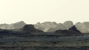
Curiosity’s recent maneuvers brought the rover within close proximity to a section of a vertical rock exposure, aptly named "Cerro Paine Grande," situated just below the suspected supersurface. This positioning allowed for detailed imaging before the rover ascended to its surface. The rover’s Mast Camera (Mastcam) played a pivotal role in capturing extensive stereo mosaics of the vertical face of the outcrop. Following the ascent, a comprehensive 360-degree panorama was acquired, providing an unparalleled overview of the surrounding landscape from its elevated vantage point.
The ascent to the top of the supersurface was a testament to Curiosity’s advanced climbing capabilities. The rover successfully maneuvered onto the plateau, reaching a final parking position at an impressive approximate 24-degree tilt. This achievement was a testament to the meticulous planning by the rover’s engineering team, who managed to position the rover at a posture suitable for crucial contact science investigations. This tilt was remarkably close to the mission’s contact science tilt record of 27 degrees, demonstrating the team’s expertise in pushing the rover’s operational limits safely.
Detailed Analysis of Ancient Martian Environments
While the rover was repositioning, its suite of scientific instruments was actively engaged in characterizing the rock layers beneath the erosional discontinuity. On Sol 4968, corresponding to Monday’s planning cycle, Lucy Lim, the Geology and Mineralogy Theme Lead for the mission, oversaw targeted investigations. The light-toned bedrock block within the workspace, identified as "Puyehue," was subjected to detailed analysis by the Alpha Particle X-ray Spectrometer (APXS), the Mars Hand Lens Imager (MAHLI), and the ChemCam instrument utilizing its Laser-Induced Breakdown Spectroscopy (LIBS) capability.
Further LIBS observations were conducted on two other geological targets. "Lago Palena," a similarly appearing bedrock block nearby, and "Piedras Juntas," an intriguing layered block situated off to the side of the primary workspace, were analyzed. These observations aim to gather detailed elemental composition data from distinct geological units, allowing scientists to compare their origins and formation processes. In addition to these rock analyses, an APXS measurement was taken on a sand target named "Cormudesi." This measurement is crucial for assessing the compositional consistency of Martian sands encountered along Curiosity’s traverse, providing insights into broader geological processes and transport mechanisms across Gale Crater.
Unveiling Stratigraphic Layers and Sedimentary Structures
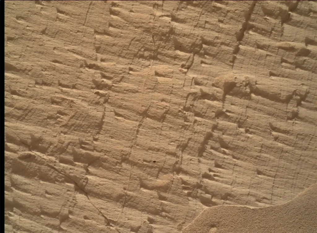
By Sol 4972, Curiosity had successfully reached the workspace atop the slope of the supersurface. Here, the bedrock presented a stark visual contrast. The local top of the outcrop featured a smooth, bedding-parallel surface, while the underlying, darker-toned, and rougher exposure of the same rocks was angled. The light-toned top surface was meticulously examined by MAHLI, APXS, and LIBS at the target designated "Sierra de Sangre." Concurrently, the darker-toned, laminated face was targeted by APXS and MAHLI at "Laguna del Laja."
The fine-scale sedimentary structures present in the textured material of "Laguna del Laja" were extensively documented through a detailed MAHLI mosaic, named "Longquimay." This mosaic was further supported by high-resolution Mastcam M100 imaging, providing a comprehensive visual record of these intricate geological features. The ability to capture such detailed imagery at multiple scales is fundamental to reconstructing the ancient depositional environments and understanding the forces that shaped them.
Comprehensive Environmental Monitoring Continues
Beyond the detailed geological investigations, the week’s science observations included several long-distance ChemCam Remote Micro-Imager (RMI) mosaics. These mosaics focused on more distant targets, including sedimentary structures located stratigraphically above the rover’s current position. These observations provide a broader geological context for the immediate findings.
Furthermore, Curiosity continued its routine monitoring of the modern Martian environment. This included regular measurements of atmospheric opacity, a critical factor in understanding dust storms and their impact on solar power for the rover. A ChemCam passive-sky survey was also conducted, a vital component in monitoring the abundances of minor atmospheric gases. This ongoing data collection contributes to our understanding of current Martian atmospheric dynamics and its long-term evolution.
Background and Significance of the Discovery
The exploration of Gale Crater by the Curiosity rover, launched on November 26, 2011, has been a cornerstone of NASA’s Mars Exploration Program. Its primary mission was to assess whether Mars ever had an environment capable of supporting microbial life. This mission has been instrumental in uncovering evidence of ancient lakebeds, river systems, and the chemical building blocks necessary for life. The current investigation into the "erosional supersurface" is a direct continuation of this objective, seeking to understand the dramatic environmental shifts that may have occurred on early Mars.
The concept of an erosional supersurface is significant because it represents a period of substantial geological upheaval. Understanding the duration and nature of the erosional phase, as well as the preceding and succeeding depositional periods, can provide insights into the climatic and hydrological history of Mars. For instance, a prolonged period of erosion might suggest a drier climate with strong winds, while the presence of fluvial deposits indicates past periods of liquid water. The transition between these states is of immense interest to planetary scientists seeking to reconstruct Mars’ habitability potential.
Timeline of Key Events
- November 26, 2011: Curiosity rover launched from Cape Canaveral Air Force Station, Florida.
- August 6, 2012: Curiosity successfully lands in Gale Crater, Mars.
- July 31, 2026 (Earth Planning Date): Curiosity reaches a position to conduct detailed imaging of the "Cerro Paine Grande" vertical exposure, just below the suspected erosional supersurface.
- Sol 4968 (Monday, approximately early August 2026): MAHLI, APXS, and ChemCam LIBS conduct detailed characterization of the "Puyehue" bedrock block.
- Sol 4972 (approximately mid-August 2026): Curiosity reaches the top of the supersurface, with MAHLI, APXS, and LIBS investigating the "Sierra de Sangre" target, and APXS and MAHLI analyzing "Laguna del Laja."
- Ongoing: Routine environmental monitoring, including atmospheric opacity and gas composition surveys, continues.
Broader Implications for Martian Science
The data collected from this investigation will contribute significantly to our understanding of Mars’ geological evolution and its past climate. By analyzing the composition and structure of the rocks at and around the erosional supersurface, scientists can refine models of Martian atmospheric and hydrological processes. The presence of distinct sedimentary layers, some indicative of water and others of wind, provides tangible evidence of past environmental dynamism.
This research has implications beyond just understanding Mars. Studying the geological processes on other planets provides comparative insights into Earth’s own history and the conditions that foster habitability. The meticulous work of the MSL team, overcoming significant engineering challenges like maneuvering the rover on steep inclines, underscores the dedication and scientific rigor driving humanity’s exploration of the cosmos.
The continued analysis of these findings will be crucial in piecing together the complex narrative of Mars’ past. Each rock, each image, and each chemical signature collected by Curiosity adds another vital chapter to our growing knowledge of the Red Planet. The mission’s success in navigating challenging terrain to access these critical geological formations is a testament to its enduring scientific value and its potential to unlock some of Mars’ most profound secrets. The data obtained in the coming sols promises to further illuminate the story of a dynamic, potentially habitable ancient Mars.