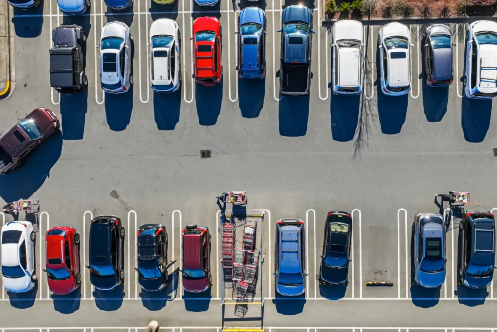
The daily commute, a routine for millions, often devolves into a frustrating scavenger hunt for parking, a hidden time sink that current navigation systems largely ignore. This oversight leads to significant delays, exacerbates urban congestion, and contributes to increased vehicle emissions. Addressing this pervasive problem, a team of researchers at the Massachusetts Institute of Technology (MIT) has developed a novel navigation system that factors in the crucial element of parking availability, promising to revolutionize how drivers approach their destinations.
The current paradigm of navigation apps, while adept at calculating driving times, falters when it comes to the realities of urban parking. Users are routinely directed to a precise destination without any consideration for the time and effort required to locate an available parking spot. This deficiency translates into more than just personal inconvenience; it fuels the vicious cycle of vehicles circling blocks, idling engines, and contributing to traffic gridlock. Furthermore, the unpredictable nature of parking can deter individuals from utilizing public transportation, as the perceived certainty of driving, despite parking challenges, often outweighs the unknown transit experience.
The MIT initiative, spearheaded by graduate student Cameron Hickert and a team of esteemed researchers, aims to rectify this fundamental flaw. Their innovative system doesn’t just point drivers to a destination; it intelligently guides them to the most advantageous parking area, balancing proximity to the desired location with a realistic assessment of parking availability. This probabilistic approach, detailed in a recent publication in the Transactions on Intelligent Transportation Systems, represents a significant leap forward in urban mobility solutions.
The Problem with Current Navigation: A Hidden Time Tax
For decades, navigation technology has primarily focused on optimizing the "point A to point B" driving time. While invaluable for avoiding traffic jams and finding the quickest driving routes, these systems have operated under a critical assumption: that parking will be readily available upon arrival. This assumption, particularly in densely populated urban centers, is frequently shattered. The consequence is a significant discrepancy between the estimated travel time and the actual time experienced by the driver.
Consider a typical scenario: a motorist relies on their navigation app for an estimated travel time of 30 minutes to a downtown meeting. However, upon reaching the vicinity of their destination, they find themselves navigating a maze of occupied parking spaces. This search can easily add another 15 to 30 minutes, or even more, to their journey. The initial 30-minute estimate becomes a misleading figure, leading to missed appointments, increased stress, and a general sense of dissatisfaction with the transportation system.
This underestimation has broader societal implications. It can discourage the adoption of sustainable transportation alternatives. If driving and parking, despite its inherent difficulties, is perceived as the only reliable option, individuals are less likely to consider public transit, cycling, or walking. This perpetuates reliance on single-occupancy vehicles, contributing to environmental degradation and straining urban infrastructure.
MIT’s Probabilistic Parking Solution: A Smarter Approach
The core of the MIT researchers’ innovation lies in a sophisticated, probability-aware system. Instead of focusing solely on the direct route to a destination, their algorithm evaluates a multitude of parking lots in the vicinity. It meticulously considers several key factors:
- Proximity to Destination: The distance from a potential parking lot to the user’s final destination is a primary consideration, as it directly impacts the walking time.
- Driving Distance to Parking: The time and effort required to drive from the current location to a particular parking lot are factored in.
- Likelihood of Parking Availability: This is the most crucial and novel element. The system estimates the probability of successfully finding a parking spot in each evaluated lot. This probability is dynamic and influenced by numerous variables, including the time of day, day of the week, local events, and the actions of other drivers.
- Contingency Planning: The system also accounts for scenarios where a driver arrives at a preferred lot and finds it full. It then intelligently suggests alternative nearby lots, considering their respective probabilities of success and walking distances.
The researchers employed a dynamic programming approach, a mathematical technique that breaks down complex problems into simpler sub-problems. By working backward from optimal outcomes (i.e., successfully parking and reaching the destination quickly), the system can calculate the most efficient route, which may involve parking further away than initially anticipated but with a much higher certainty of securing a spot.
"This frustration is real and felt by a lot of people," stated Cameron Hickert, the lead author of the study. "And the bigger issue here is that systematically underestimating these drive times prevents people from making informed choices. It makes it that much harder for people to make shifts to public transit, bikes, or alternative forms of transportation."
Simulated Success: Real-World Data and Promising Results
To validate their methodology, the MIT team conducted extensive simulated tests using real-world traffic data from Seattle, a city known for its urban density and parking challenges. The simulations encompassed various times of day and different levels of traffic congestion, from bustling city centers to more suburban areas.
The results were compelling. In the most congested settings, the new system achieved remarkable time savings, reducing overall travel time by up to 66 percent compared to simply driving to the closest parking lot and waiting for a spot to open. This translates to an average saving of approximately 35 minutes for a typical trip, a substantial improvement that can make a significant difference in a commuter’s day. Even when compared to a strategy of continuously driving to the next closest available parking lot, the MIT system demonstrated an improvement of around 20 percent.
These findings underscore the significant impact that incorporating parking intelligence into navigation can have. The ability to predict and account for parking availability transforms a driver’s journey from a gamble into a calculated and efficient endeavor.
The Dynamics of Parking: A Complex Ecosystem
The success of the MIT system hinges on its ability to accurately model the complex dynamics of parking. It recognizes that parking availability is not a static quantity but a constantly fluctuating resource influenced by the collective behavior of all drivers.
The system accounts for scenarios such as:
- Competition for Spots: The probability of finding a spot in a particular lot is directly influenced by how many other drivers are also seeking parking.
- Sequential Decision-Making: If a driver fails to secure a spot in their first choice, their subsequent decision-making process is affected by the availability of alternative lots. The MIT system models this iterative process.
- Spillover Effects: When popular parking lots are full, drivers may seek parking in adjacent areas, potentially increasing demand and reducing availability in previously less crowded locations.
"With our framework, we show how you can model all those scenarios in a very clean and principled manner," Hickert elaborated. This sophisticated modeling allows the system to predict not just the likelihood of parking but also the most efficient sequence of actions a driver should take.
Crowdsourcing Parking Data: A Feasible Future
A critical challenge in implementing such a system in the real world is the collection of accurate and up-to-date parking availability data. While some advanced parking facilities are equipped with sensors that track occupancy, these are not universally adopted. To address this, the MIT researchers explored the viability of crowdsourced data.
Their study indicated that crowdsourced observations of parking availability could achieve an error rate of only about 7 percent compared to actual parking availability. This suggests that leveraging user-reported information could be a highly effective and scalable method for gathering the necessary data.
Potential sources of crowdsourced data include:
- User-Reported Availability: Drivers could simply indicate "parking available" or "no parking" through a navigation app.
- Vehicle Circling Data: Tracking the number of vehicles circling an area in search of parking could serve as an indirect indicator of scarcity.
- Unsuccessful Parking Attempts: Data on vehicles entering a lot and exiting without parking could also provide valuable insights.
- Autonomous Vehicle Reporting: In the future, self-driving cars could automatically report on open parking spots they encounter.
"Right now, a lot of that information goes nowhere," Hickert noted. "But if we could capture it, even by having someone simply tap ‘no parking’ in an app, that could be an important source of information that allows people to make more informed decisions."
Broader Implications and Future Directions
The implications of this research extend far beyond individual driver convenience. By providing more accurate travel time estimates, the system can empower individuals to make better transportation choices. This could lead to a significant shift towards public transit, cycling, and other sustainable modes of transport, thereby reducing traffic congestion, lowering carbon emissions, and improving urban air quality.
The researchers envision this technology being integrated into existing navigation platforms, providing users with a more realistic and less stressful travel experience. The system’s adaptability means it could be deployed in various urban environments, from bustling metropolises to smaller towns.
Looking ahead, the MIT team plans to conduct larger-scale studies, incorporating real-time route information across entire cities. They are also exploring additional data collection methods, such as the use of satellite imagery, and aim to quantify the potential emissions reductions achieved by their system.
"Transportation systems are so large and complex that they are really hard to change," said senior author Cathy Wu, Associate Professor in Civil and Environmental Engineering and the Institute for Data, Systems, and Society at MIT. "What we look for, and what we found with this approach, is small changes that can have a big impact to help people make better choices, reduce congestion, and reduce emissions."
This pioneering research, supported by grants from Cintra, the MIT Energy Initiative, and the National Science Foundation, represents a significant stride towards a more efficient, sustainable, and user-friendly urban transportation ecosystem. By acknowledging and intelligently addressing the often-overlooked challenge of parking, MIT’s navigation system offers a glimpse into a future where our journeys are not only faster but also smarter and more environmentally conscious. The daily frustration of the parking hunt may soon become a relic of the past, replaced by informed decisions and a smoother commute for all.