The increasingly congested expanse of low Earth orbit (LEO), a region now teeming with thousands of active satellites and a growing population of space debris, presents a critical challenge for the future of space exploration and utilization. Even at altitudes of several hundred kilometers, the subtle yet persistent drag exerted by the tenuous traces of Earth’s upper atmosphere can significantly alter satellite trajectories. Accurate measurement of atmospheric density at these crucial heights is therefore paramount for precisely forecasting satellite motion and, critically, mitigating the escalating risk of potentially catastrophic collisions.
Understanding the Thermosphere’s Elusiveness
At the heart of this atmospheric challenge lies the thermosphere, a vast layer that constitutes over 99 percent of the upper atmosphere and is primarily composed of electrically neutral gas. Thermospheric density, a key metric for understanding the forces acting upon orbiting objects, refers to the concentration of this neutral atmosphere between approximately 100 and 1000 kilometers above Earth’s surface. In stark contrast, the ionized gases that form the ionosphere, while crucial for radio wave propagation and thus relatively easier to observe, account for less than one percent of this atmospheric domain. The inherent difficulty in directly measuring the conditions within the neutral thermosphere has long been a significant hurdle for space scientists and engineers alike.
A Groundbreaking Approach: Visualizing the Invisible
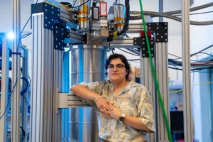
The imperative for enhanced thermospheric density measurements extends beyond fundamental atmospheric research; it holds direct and vital implications for space engineering. Recognizing this dual need, researchers at Kyoto University have pioneered a novel technique designed to visualize this notoriously difficult-to-observe region. This multidisciplinary endeavor, as described by corresponding author Mamoru Yamamoto, bridges the fields of space science and space engineering. "Reading papers from both research fields, we realized that deeper dialogue between researchers from both fields is necessary," Yamamoto stated, highlighting the interdisciplinary nature of their breakthrough.
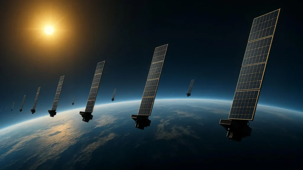
The innovative methodology employed by the Kyoto University team involves the application of tomography, a technique widely recognized for its utility in medical imaging, to the complex environment of Earth’s upper atmosphere. By meticulously analyzing the gradual decay of satellite orbits—a phenomenon directly attributable to atmospheric drag—the researchers were able to infer and estimate thermospheric density. Their initial application of this technique focused on approximately 1,200 Starlink satellites, all operating at an altitude of 482 kilometers, utilizing publicly available orbital data.
Constructing a Two-Dimensional Atmospheric Tapestry
The culmination of this tomographic analysis is the creation of a two-dimensional snapshot, mapping thermospheric density across latitude and longitude at an altitude of roughly 500 kilometers. This represents a significant advancement, marking what the team asserts is the first tomographic reconstruction of its kind for this atmospheric layer. The generated density patterns have exhibited a remarkable degree of consistency with independent observations obtained from the European Space Agency’s (ESA) SWARM satellites. The SWARM mission, specifically designed to measure variations in Earth’s magnetic field and gravity, also provides valuable data on atmospheric density along its orbital paths, offering a crucial point of validation for the Kyoto University team’s findings.
This latest work builds upon a foundational study conducted by the same research group. In their earlier research, scientists had focused on estimating temporal and altitudinal variations in thermospheric density using general orbital information derived from Starlink satellites, known as Two-Line Element (TLE) data. The current analysis represents a substantial expansion, introducing a new dimension by examining horizontal density variations across latitude and longitude. This horizontal mapping provides an unprecedented glimpse into the thermosphere’s geographical structure, revealing a more nuanced understanding of its dynamic nature.
Enhancing Orbital Safety in a Crowded Space Environment
The practical implications of this breakthrough are profound, particularly as the number of objects traversing Earth’s orbits continues its rapid ascent. More precise and comprehensive data on atmospheric density is crucial for refining predictions of satellite motion. This enhanced predictive capability directly translates to a reduced probability of collisions, not only between operational satellites but also between satellites and the growing population of hazardous space debris. The International Space Station (ISS) and its crew, for instance, have had to undertake numerous avoidance maneuvers due to potential collisions with debris, underscoring the urgency of improved tracking and prediction.
Furthermore, the tomographic technique holds the potential to enable near-real-time measurements of atmospheric density in the vicinity of satellites. Such continuous monitoring could significantly enhance space weather forecasting, providing critical alerts about solar events and geomagnetic storms that can impact satellite operations and terrestrial infrastructure. Ultimately, this advanced understanding and monitoring capability will contribute to safer, more reliable, and more sustainable satellite operations in the increasingly crowded domain of low Earth orbit.
The Growing Challenge of Space Congestion
The urgency behind this research is amplified by the exponential growth in satellite constellations. Projects like SpaceX’s Starlink, OneWeb, and Amazon’s Project Kuiper are deploying thousands of satellites, dramatically increasing the density of objects in LEO. While these constellations promise enhanced global internet connectivity and other services, they also introduce significant challenges related to space traffic management and collision avoidance. The European Space Agency (ESA) estimates that the number of trackable objects in orbit has exceeded 30,000, with the majority of this being space debris. Uncontrolled collisions can trigger cascading effects, known as the Kessler Syndrome, where a single collision generates thousands of new pieces of debris, rendering certain orbital altitudes unusable.
The atmospheric drag experienced by satellites is not a constant force. It is influenced by several factors, including solar activity, which causes the upper atmosphere to expand and heat up, increasing density. The solar cycle, an approximately 11-year period of solar activity, directly impacts thermospheric density. During periods of high solar activity, the thermosphere can expand significantly, increasing drag on satellites. Accurate models are essential to predict these variations and their impact on satellite orbits.
Historical Context and Previous Efforts
The challenge of tracking and predicting satellite motion due to atmospheric drag has been a concern since the early days of spaceflight. Early orbital tracking relied on ground-based radar and optical observations, providing data that was often sparse and subject to significant uncertainty. The development of TLE data, a standard format for representing the orbital elements of Earth-orbiting objects, has been instrumental in enabling more widespread orbital propagation. However, TLE data, while useful, provides a simplified representation of orbital parameters and does not inherently capture the fine-grained atmospheric conditions that influence drag.
More sophisticated atmospheric models have been developed over the decades, incorporating solar and geomagnetic indices to predict density variations. However, these models often rely on statistical averages and empirical relationships, which may not always accurately reflect the localized and dynamic conditions experienced by individual satellites. The Kyoto University approach offers a novel way to directly infer thermospheric density from the observed behavior of satellites themselves, providing a data-driven validation and refinement of existing models.
Expert Reactions and Future Outlook
While specific public statements from external organizations directly reacting to this particular Kyoto University study were not immediately available, the broader scientific and engineering communities have long advocated for improved atmospheric density measurements. Dr. Moriba Jah, a leading expert in space traffic management and a professor at the University of Texas at Austin, has consistently emphasized the need for better space situational awareness, including accurate atmospheric modeling. "We need to know where everything is, what it’s doing, and what forces are acting upon it," Dr. Jah has stated in previous contexts. "Understanding the atmospheric drag is a critical piece of that puzzle, especially for predicting collisions and ensuring the long-term sustainability of space operations."
The Kyoto University team’s tomographic technique represents a significant step towards achieving this enhanced situational awareness. The ability to generate detailed, two-dimensional maps of thermospheric density could revolutionize how we plan and execute space missions. For instance, satellite operators could use these maps to optimize orbital maneuvers, minimizing fuel consumption and extending satellite lifespan. Furthermore, such detailed atmospheric data could be integrated into more sophisticated space traffic management systems, enabling proactive collision avoidance strategies.
The long-term implications of this research extend to the very future of space exploration and commercialization. As humanity increasingly relies on satellites for communication, navigation, Earth observation, and scientific research, ensuring the safety and sustainability of the orbital environment is paramount. By providing a more accurate and granular understanding of the forces that govern satellite motion, this new tomographic technique contributes directly to that critical goal. It offers a path toward not only mitigating current risks but also enabling the confident expansion of human activity in space for generations to come. The continued development and refinement of such innovative observational techniques will be essential in navigating the complex and ever-evolving frontier of Earth’s orbital domain.