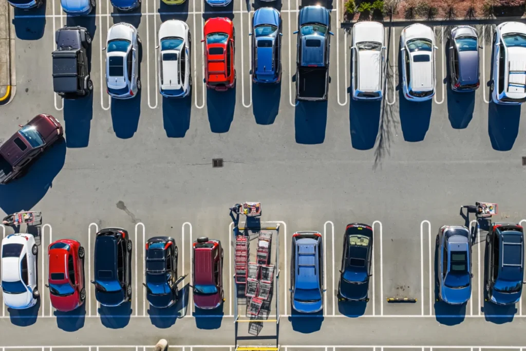
A groundbreaking development from the Massachusetts Institute of Technology (MIT) promises to alleviate a common urban frustration: the elusive parking spot. Researchers have developed an intelligent system that goes beyond simply directing drivers to their destinations, instead guiding them to the parking location most likely to offer availability, thereby saving significant time, reducing traffic congestion, and potentially encouraging a shift towards more sustainable transportation options. This innovative approach tackles a systemic flaw in current navigation technologies, which often lead drivers to their exact destination without accounting for the often-substantial time spent searching for parking.
The implications of this research, published in the Transactions on Intelligent Transportation Systems, are far-reaching, addressing not only the individual inconvenience of circling the block but also the broader societal issues of increased fuel consumption, elevated emissions, and diminished public transit appeal. By providing a more accurate estimation of total travel time, the system aims to empower drivers with the information needed to make more informed decisions, potentially rerouting them to public transportation hubs or alternative modes of travel when driving and parking prove to be less efficient.
The Frustration of the Final Mile
The daily reality for countless urban commuters involves a familiar cycle: consulting a navigation app for an estimated travel time, only to arrive at their destination and face a prolonged search for parking. This discrepancy between estimated and actual arrival times can lead to missed appointments, increased stress, and a pervasive sense of inefficiency. Current navigation systems, while adept at calculating route distances and traffic flow, typically fail to incorporate the crucial variable of parking availability. This oversight results in underestimations of total trip duration, contributing to what researchers term the "parking penalty."
This parking penalty has tangible consequences beyond individual inconvenience. The act of cruising for parking spots is a significant contributor to urban traffic congestion, particularly in densely populated areas. Vehicles circling parking lots or searching on streets increase the overall volume of traffic, exacerbating delays for all road users. Furthermore, this prolonged idling and slow-speed driving directly translates to increased fuel consumption and a higher output of harmful emissions, impacting air quality and contributing to climate change.
Perhaps one of the most significant, yet often overlooked, consequences of this navigational blind spot is its effect on public transit ridership. When navigation apps present a driving route that appears comparable in time to public transit, but fail to account for parking time, drivers may opt for their cars without realizing that the actual journey, including parking, could be considerably longer and more inconvenient than taking a bus or train. This miscalculation can dissuade potential public transit users, perpetuating reliance on private vehicles and reinforcing the cycle of congestion and pollution.
MIT’s Probabilistic Approach to Parking Precision
Recognizing these multifaceted challenges, a team of researchers at MIT has developed a novel system designed to optimize the entire journey, from origin to destination, with a specific focus on the parking phase. Their approach moves beyond simply identifying the closest parking lot to a destination. Instead, it intelligently analyzes a range of factors to pinpoint parking areas that offer the optimal balance between proximity to the desired location and the highest probability of securing a parking space.
The core of their innovation lies in a "probability-aware" methodology. This system considers not just the physical distance to potential parking lots but also the estimated time required to drive to each, the subsequent walking distance from the parking spot to the final destination, and critically, the likelihood of finding an available space. This nuanced understanding of the parking landscape allows the system to recommend an ideal parking area rather than a specific, potentially full, parking lot.
Simulated Successes: A Glimpse into the Future of Navigation
To validate their innovative approach, the MIT researchers conducted extensive simulated tests using real-world traffic data from Seattle, a city known for its dynamic and often congested urban environment. The results of these simulations were compelling. In the most challenging, highly congested scenarios, the system demonstrated the potential to achieve time savings of up to an impressive 66 percent compared to traditional navigation methods.
For an individual motorist, this translates into a substantial reduction in travel time. The simulations indicated that drivers using this new system could save approximately 35 minutes on a typical trip, a significant improvement over the time often lost waiting for a spot to open in the nearest parking lot. This efficiency gain, multiplied across thousands of daily commutes, could have a profound impact on overall traffic flow and urban livability.
While the researchers acknowledge that a fully deployable, real-world system is still under development, their demonstrations have clearly established the viability and immense potential of their approach. The simulations provide a robust foundation for understanding how this technology could be integrated into existing navigation platforms and smart city infrastructure.
Informed Choices, Sustainable Shifts
Cameron Hickert, an MIT graduate student and lead author on the paper detailing this research, emphasized the broader significance of their work. "This frustration is real and felt by a lot of people," Hickert stated, "and the bigger issue here is that systematically underestimating these drive times prevents people from making informed choices. It makes it that much harder for people to make shifts to public transit, bikes, or alternative forms of transportation."
Hickert’s sentiment underscores the critical link between accurate travel time estimations and the adoption of sustainable mobility options. By providing a more realistic picture of the complete journey, including the often-unaccounted-for parking time, the MIT system empowers individuals to make better decisions about how they travel. This could lead to a significant increase in public transit usage, as the perceived time advantage of driving diminishes when parking realities are factored in. Similarly, it could encourage more people to consider cycling or walking for shorter trips, further reducing their carbon footprint and contributing to healthier, more active communities.
The research team, comprising Cameron Hickert, Sirui Li (PhD ’25), Zhengbing He (research scientist at the Laboratory for Information and Decision Systems – LIDS), and senior author Cathy Wu (Associate Professor in Civil and Environmental Engineering and the Institute for Data, Systems, and Society at MIT, and a member of LIDS), has laid the groundwork for a future where urban navigation is not just about reaching a point on a map, but about optimizing the entire travel experience with a holistic understanding of urban dynamics.
The Mechanics of Probabilistic Parking
The system’s sophisticated logic is rooted in dynamic programming, a computational technique that breaks down complex problems into simpler, overlapping subproblems. In this context, the algorithm works backward from the desired outcome – arriving at the destination efficiently – to calculate the optimal route and parking strategy.
The "probability-aware" aspect is crucial. It means the system doesn’t just suggest the nearest parking lot. Instead, it meticulously analyzes all publicly accessible parking options within a reasonable vicinity of the destination. For each potential lot, it considers:
- Driving Time: The estimated time to reach the parking lot from the user’s current location, factoring in current traffic conditions.
- Walking Distance: The time it would take to walk from the parking spot to the final destination.
- Probability of Availability: This is the most innovative component. The system estimates the likelihood of finding an open parking spot in each lot based on historical data, time of day, day of the week, and other relevant factors.
Furthermore, the system is designed to be resilient to the inherent uncertainty of parking. It accounts for scenarios where a user might arrive at their initially recommended parking lot only to find it full. In such cases, the system can dynamically reroute the driver to an alternative lot, factoring in the additional driving time and the probability of success at the next best option.
"If there are several lots nearby that have slightly lower probabilities of success, but are very close to each other, it might be a smarter play to drive there rather than going to the higher-probability lot and hoping to find an opening," explained Hickert. "Our framework can account for that." This intelligent consideration of clustered parking options adds another layer of sophistication, ensuring that drivers aren’t sent on a wild goose chase to a single, potentially distant, high-probability lot.
The ultimate goal of the system is to identify the optimal parking lot that minimizes the expected total time required for driving, parking, and walking to the destination. This holistic optimization ensures that the user’s time is prioritized throughout the entire journey.
Accounting for the Human Element: Modeling Driver Behavior
A critical aspect of real-world urban driving is that no motorist operates in a vacuum. The actions of other drivers significantly influence parking availability. The MIT system intelligently incorporates these crowd dynamics into its calculations. It models scenarios where:
- Competition for Spots: Another driver might arrive at a user’s preferred lot just moments before and take the last available space.
- Cascading Effects: A driver initially unsuccessful in finding parking at one lot might then try another, potentially impacting the availability at that secondary location.
- Spillover Congestion: Drivers unable to find parking in designated lots may resort to parking in less conventional areas, leading to congestion in surrounding neighborhoods.
"With our framework, we show how you can model all those scenarios in a very clean and principled manner," Hickert elaborated. By quantifying the impact of these dynamic interactions, the system can provide more realistic and reliable recommendations, even in the most competitive parking environments.
The Power of Crowdsourced Data for Parking Availability
The accuracy of any predictive system hinges on the quality and availability of data. While some parking lots are equipped with sensors or automated gates that track occupancy, such infrastructure is not universally deployed. To overcome this limitation and ensure broad applicability, the MIT researchers explored the efficacy of crowdsourced data.
This approach leverages the collective intelligence of drivers themselves. Imagine a scenario where users of a navigation app can simply indicate when they’ve found a parking spot or, conversely, when they’ve circled a lot without success. This real-time feedback, aggregated across numerous users, can provide invaluable insights into parking availability.
The possibilities for data collection are diverse:
- User-Reported Availability: Drivers can actively report open spots or the absence thereof through a simple app interface.
- Vehicle Movement Patterns: Analyzing the number of vehicles circling a particular area or entering and exiting parking lots without parking can indicate low availability.
- Autonomous Vehicle Data: In the future, autonomous vehicles could automatically report on vacant parking spots they pass, creating a rich, real-time data stream.
"Right now, a lot of that information goes nowhere," Hickert noted. "But if we could capture it, even by having someone simply tap ‘no parking’ in an app, that could be an important source of information that allows people to make more informed decisions." This democratized approach to data collection makes the system scalable and adaptable to various urban settings.
Real-World Validation and Future Horizons
The researchers rigorously evaluated their system’s performance using actual traffic data from the Seattle metropolitan area. They simulated various scenarios, encompassing both congested urban cores and less dense suburban areas, across different times of day. The findings reaffirmed the system’s effectiveness, showing significant reductions in total travel time.
In congested urban settings, the probabilistic parking system reduced total travel time by approximately 60 percent compared to simply waiting for a spot to become available in the closest lot. Furthermore, it offered a substantial 20 percent improvement over a strategy of continuously driving to the next closest parking lot.
Critically, the study also assessed the reliability of crowdsourced parking availability data. The results indicated an error rate of only about 7 percent compared to actual parking availability, demonstrating that this method is a highly effective means of gathering the necessary data for the system to function optimally.
Looking ahead, the MIT team plans to expand their research to encompass larger-scale studies. They aim to implement their system using real-time route information across entire cities, providing a more comprehensive understanding of its impact on urban mobility. Additionally, they are exploring novel methods for data acquisition, such as utilizing satellite imagery, and are keen to quantify the potential for emissions reductions resulting from the widespread adoption of their predictive parking technology.
Professor Cathy Wu, the senior author of the study, highlighted the transformative potential of small, data-driven interventions in complex transportation systems. "Transportation systems are so large and complex that they are really hard to change," Wu stated. "What we look for, and what we found with this approach, is small changes that can have a big impact to help people make better choices, reduce congestion, and reduce emissions."
This groundbreaking research, supported in part by Cintra, the MIT Energy Initiative, and the National Science Foundation, represents a significant leap forward in intelligent transportation systems. By addressing the overlooked but critical challenge of parking, MIT’s predictive parking system holds the promise of creating more efficient, less congested, and environmentally sustainable urban environments for all.