A groundbreaking study by researchers at the MIT Senseable City Lab has unveiled the transformative potential of visual artificial intelligence (AI) in understanding and managing urban environments. Published a few months ago, this research introduces innovative methodologies, particularly in leveraging machine learning to analyze data from city traffic cameras. By identifying vehicle types and estimating their emissions in real-time, the study demonstrates a powerful new capability for monitoring urban pollution with unprecedented precision and scale. This advancement is not an isolated technical feat but a significant step in a broader evolution of urban planning and analysis, as explored in the new book "How AI Sees the City: Urban Visual Intelligence," co-authored by MIT researchers.
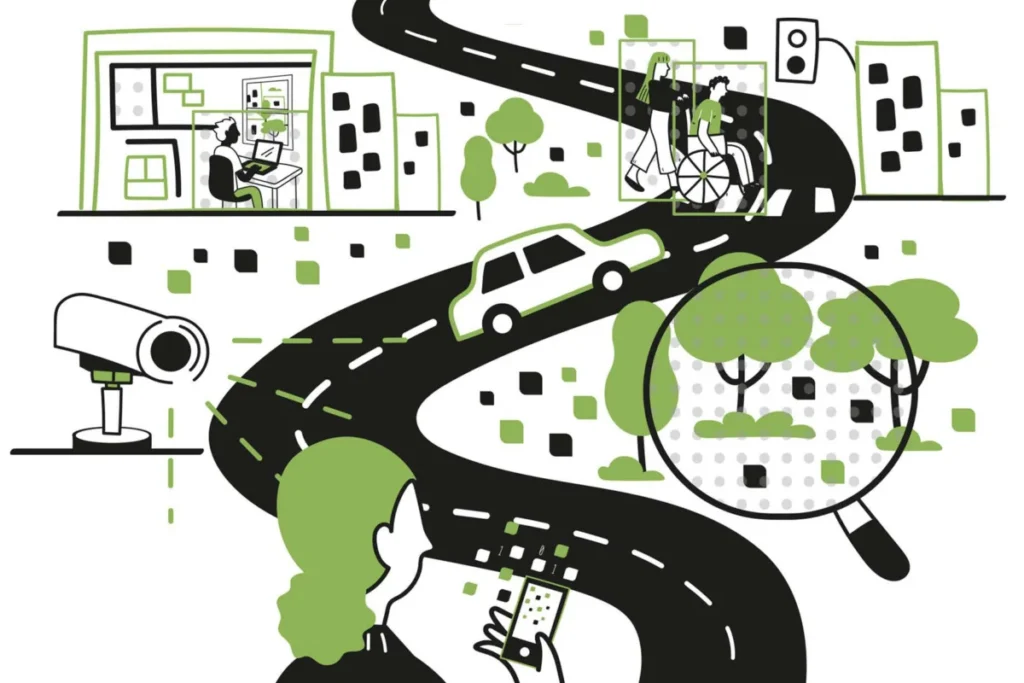
The core of this new approach lies in treating digital images, abundant in our increasingly surveilled urban landscapes, as rich datasets. Fabio Duarte, an MIT researcher and co-author of the book, elaborates on this concept: "We can treat these digital images as data and quantify features of the city. With computer vision techniques, each image is a dataset." This paradigm shift allows urban planners to move beyond traditional, often time-consuming, methods of data collection and analysis. The implications are far-reaching, enabling answers to complex questions that have long eluded urbanists. For instance, visual AI can pinpoint the exact causes of traffic congestion, identify the most hazardous elements within busy intersections, and quantify the usage patterns of public spaces like plazas and parks, revealing which areas are most frequented and by whom.
This expansion of visual data analysis is not entirely new in principle, but the scale and detail are revolutionary. As Martina Mazzarello, another co-author and research scientist at MIT, notes, "Everybody has been observing the urban environment and trying to get some insight. But what if we can do that at a large scale and get some insight everywhere?" This question underscores the central theme of the book, which traces the lineage of urban visual intelligence from early observational methods to the sophisticated AI-driven techniques of today.
A New Era of Urban Observation
The book, "How AI Sees the City: Urban Visual Intelligence," published by Routledge, delves into this convergence of AI and urban studies. Authored by Fabio Duarte, Martina Mazzarello, Carlo Ratti (founder and director of the MIT Senseable City Lab), and Fan Zhang (from Peking University), it positions visual AI as the latest evolution in a long tradition of understanding cities through observation. Carlo Ratti emphasizes this continuity, stating, "Great urbanists such as Kevin Lynch and William H. Whyte showed us the extraordinary value of ‘looking’ at the city. Today, visual AI gives us new ways to build on that tradition – allowing us to observe cities at a scale and with a level of detail that was previously impossible."
The MIT Senseable City Lab, established in 2004, has consistently focused on utilizing data to unravel urban dynamics. The book contextualizes the current AI-driven revolution within a historical framework of visual urban analysis. This history includes early efforts like the marble maps of ancient Rome, the advent of photography that captured the dramatic transformations of cities like Paris under Haussmann or the crowded tenements of 19th-century New York, and the influential works of urban thinkers like Kevin Lynch, whose 1960 book "The Image of the City" profoundly shaped architectural and urban planning discourse. Sociologist William H. Whyte, known for his work on public spaces, also contributed significantly to this tradition of visual urban study.
By framing AI as a continuation of this established practice, the authors argue that it serves as a powerful tool to augment, rather than replace, human insight in urban design and planning. Fabio Duarte illustrates this point by comparing contemporary capabilities to historical ones: "Kevin Lynch at MIT was only using paper and pen. We can now scale up what he was doing, with visual AI, while also looking at many different dimensions of cities."
Expanding the Scope of Urban Insight
The applications of visual AI in urban planning are vast and varied. Beyond environmental monitoring and traffic management, the technology can enhance the understanding of urban safety by identifying dangerous intersections and pedestrian flow patterns. It can also provide detailed insights into the use and appeal of public spaces, informing designs that better serve community needs. For example, the book discusses the analysis of urban greenery. While satellite imagery can provide an overview of tree cover and green space, visual AI can analyze imagery from street-level cameras and personal devices to understand how frequently residents interact with or perceive these green elements, a factor linked to well-being.
Fan Zhang highlights the deeper promise of this technology: "The real promise of visual AI is not simply that computers can look at millions of images. It is that we can connect what is visible in those images – streets, buildings, greenery, traffic, public space – with larger questions about how cities function and how people experience them." This connection between the visible and the experiential is crucial for creating more livable and responsive urban environments.
The capabilities extend even to the analysis of urban interiors. A recent study by the Senseable City Lab, using images from hundreds of thousands of Airbnb listings globally, found that interior design styles, contrary to some assumptions, do not exhibit global homogenization. Instead, they reveal distinct regional variations, offering insights into cultural preferences and local aesthetics.
Martina Mazzarello concludes that "No matter what it is, we can learn from what we can see and then use it as urban designers, planners, policymakers, and citizens. It can be our eyes, or cameras with computers, but in the end it’s the same methodology, and now we are trying to optimize the ways we can use these tools."
Navigating the Promise and the Pitfalls
While the potential benefits of visual AI in urban studies are substantial, the authors of "How AI Sees the City" also critically address the inherent risks and ethical considerations. These concerns primarily revolve around the potential for widespread surveillance and the perpetuation of societal biases within AI systems.
The proliferation of cameras in urban spaces, a trend already significant in many global cities, raises immediate privacy concerns. London, for instance, is known for its extensive CCTV network, with approximately 210 cameras per square mile. However, this pales in comparison to cities in China, where Shanghai reportedly has over 5,000 cameras per square mile. Such dense surveillance networks have sparked considerable debate worldwide regarding their impact on personal freedom and the potential for misuse. The book cautions that "the benefits must be weighed against the significant erosion of personal freedom and the potential for abuse inherent in a system of constant monitoring."
Furthermore, AI systems are not inherently neutral. They are trained on data, and if that data reflects existing societal biases, the AI will learn and potentially amplify those biases. For example, if AI models are primarily trained on data representing majority populations, their analysis and decision-making processes might not accurately or fairly represent minority groups. Fabio Duarte emphasizes this point: "We need to teach AI to see, and depending on how you teach it, it will see what is embedded in the culture. AI is not neutral."
Despite these challenges, the authors maintain a balanced perspective. Mazzarello points out that human observation is also subjective: "our eyes are not neutral, either. Every tool has to be guided in the right way, and trained in the best way." This underscores the need for careful development, implementation, and ongoing critical evaluation of AI technologies in urban contexts.
A Call for Wise Exploration
The book has garnered positive reception from the academic community. Michael Batty of University College London described it as a "fascinating book" that "shows how we are beginning to interpret the world of urban design, suggesting ways in which we might improve design using urban analytics, AI and large language models."
Ultimately, the authors advocate for a cautious yet optimistic approach to deploying visual AI for urban improvement. They believe that by embracing this technology with critical thinking and a commitment to ethical deployment, significant progress can be made in understanding and enhancing urban life. As they conclude in their book, "We should explore this wisely, critically, and creatively." This call to action emphasizes that the future of our cities will be shaped not only by the power of AI but by the thoughtful and responsible manner in which we choose to wield it. The ongoing development and application of visual AI promise to offer deeper insights into the complex tapestry of urban existence, enabling a more informed and potentially more equitable future for cities worldwide.